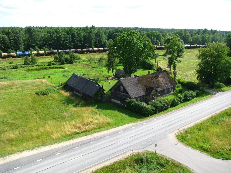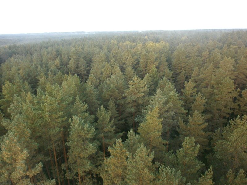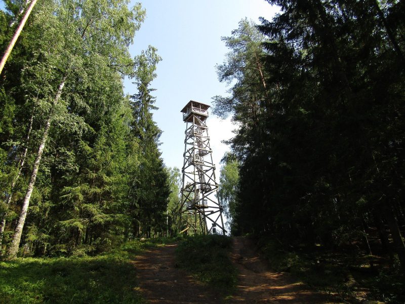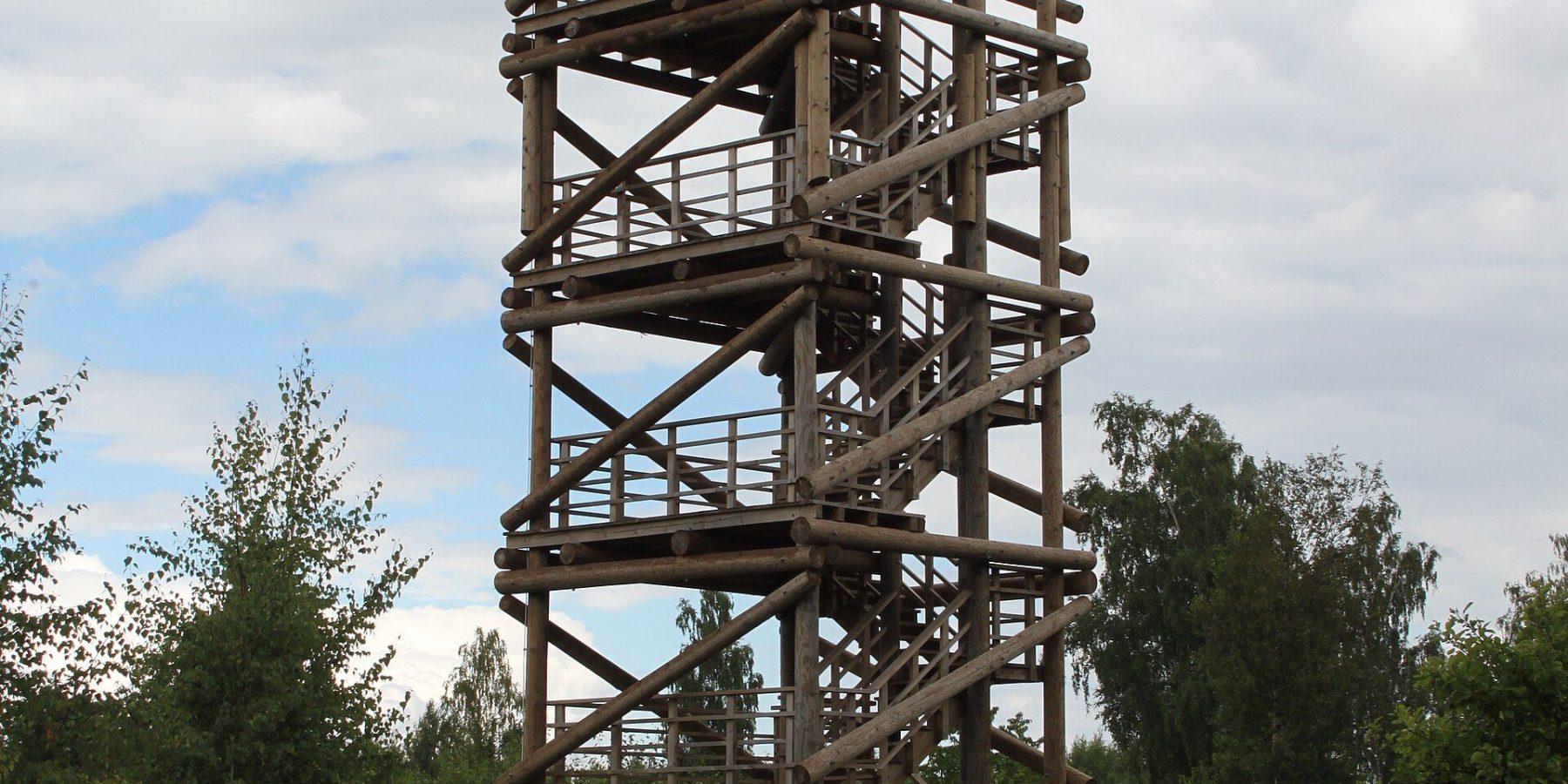
The highest summit of the Sēlija Upland is Ormaņkalns — 167 metres above sea level. Right next to it, on Borīši hill, stands an observation tower usually called the Ormaņkalns tower. From the top you look out over Lake Sauka — the largest lake in Sēlija — and a rolling landscape of woods and fields that feels very different from the flat Zemgale plain just a few dozen kilometres away.
At a glance
| Location | Borīši hill next to Ormaņkalns, Elkšņi parish, Jēkabpils municipality |
| Ormaņkalns | 167 m above sea level, 86.5 m relative height |
| Tower height | not officially published (OpenStreetMap gives 30 m) |
| Protected area | Sauka Nature Park (since 1987, 54 km²) |
| Access | the tower stands on private land; about 200 m on foot from the road |
| Steps | not officially published |
| What you see | Lake Sauka, the forests, fields and farmsteads of the Sēlija Upland |
The roof of Sēlija
The Sēlija Upland is a belt of hills 8–20 km wide that starts on the left bank of the Daugava opposite Pļaviņas and runs south. It formed about 14,000 years ago where two ice flows met, and its summits rise 145–185 m above sea level. At 167 metres Ormaņkalns is the highest point of the upland, and its largely open top and steep slopes already give a wide view on their own.
In the tales of writer Jānis Veselis, Ormaņkalns once held a sacred grove watched over by the chieftain of Sauka hillfort. People gathered there for meetings and festivals — and from this “calling” (Latvian “saukt”) the name Sauka is said to come. About 600 m from the hill lies the Kalndruvas sacred stone.
Sauka Nature Park from above
The tower is the best place to take in Sauka Nature Park. Protected since 1987, it covers 54 km² across Sauka, Elkšņi and Rite parishes, and at its heart lies Lake Sauka — 718 hectares, about 79 m above sea level and ringed by hills 10–15 m high. The park is home to 37 protected bird species, as well as otters, beavers and pond bats.
From the tower you can see clumps of forest alternating with fields and farmsteads, with the lake shining below. OpenStreetMap gives the tower a height of 30 m, but official tourism sources do not state it.
Did you know?
According to Jānis Veselis’s tales, people were “called” (saukti) to gatherings in the sacred grove on Ormaņkalns — and that is how the area and the lake are said to have got the name Sauka.
Visiting
- Getting there: by car to Sauka Nature Park in Elkšņi parish, between Viesīte and Nereta; follow signs to Ormaņkalns.
- Parking: the tower is on private land — leave the car at the roadside and walk about 200 m. There is a rest area at Ormaņkalns.
- Hours and price: no official opening hours or fee are published. For current information contact the Jēkabpils Municipality TIC, +371 29555950.
- Safety: take care in wind and in winter — it is colder at the top and the steps can be slippery.
- Accessibility: stairs only; not suitable for wheelchairs.
- Respect: you are on private land — take your litter home, keep off crops and don’t drive into the fields.
- Combine with: Sunākste Church near Viesīte, Sēlpils castle mound and Jēkabpils — see Things to do in Jēkabpils.
FAQ
Is the tower on Ormaņkalns itself?
Tourism information says the tower known as the Ormaņkalns tower stands on neighbouring Borīši hill. Ormaņkalns itself, at 167 m, is the highest point of the Sēlija Upland.
How high is Ormaņkalns?
167 m above sea level, with a relative height of 86.5 m.
What can you see from the tower?
Lake Sauka and the forests, fields and farmsteads of Sauka Nature Park — a classic Sēlija hill landscape.
Sources: visit.jekabpils.lv (Ormaņkalns hill and observation tower); lv.wikipedia.org “Ormaņkalns” and “Saukas dabas parks”; Sēlija tourism materials; redzet.lv (Borīši hill observation tower); OpenStreetMap.